

| Región | Región/Província | Superfície província | Superfície forestal | %f | Superfície arbolada (Bosque) | %a | Otros terrenos forestales | %o | Fuente |
|---|---|---|---|---|---|---|---|---|---|
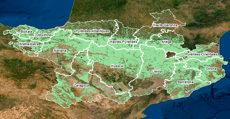
| ARAGÓN | Huesca | 1.563.616 | 934.085 | 59,74 | 620.223 | 66,40 | 313.863 | 33,60 | IFN3 |
| ARAGÓN | Zaragoza | 1.727.423 | 744.058 | 43,07 | 371.355 | 49,91 | 372.704 | 50,09 | IFN3 |
| CATALUNYA | Barcelona | 772.836 | 491.684 | 63,62 | 469.812 | 95,55 | 21.872 | 4,45 | IFN3 |
| CATALUNYA | Girona | 590.989 | 415.654 | 70,33 | 365.930 | 88,04 | 49.724 | 11,96 | IFN3 |
| CATALUNYA | Lleida | 1.217.257 | 733.801 | 60,28 | 537.883 | 73,30 | 195.918 | 26,70 | IFN3 |
| NAVARRA | Navarra | 1.039.069 | 594.356 | 57,20 | 437.079 | 73,54 | 157.277 | 26,46 | IFN4 |
| NOUVELLE-AQUITAINE | Pyrénées-Atlantiques | 771.000 | 286.000 | 37,09 | 244.740 | 85,57 | 41.260 | 14,43 | IGN 2013 |
| OCCITANIE | Ariège | 489.000 | 259.170 | 53,00 | 201.139 | 77,61 | 58.031 | 22,39 | IGN 1989-1990 |
| OCCITANIE | Haute-Garonne | 630.900 | 132.489 | 21,00 | 125.386 | 94,64 | 7.103 | 5,36 | IGN 2000 |
| OCCITANIE | Hautes-Pyrénées | 454.000 | 298.000 | 65,64 | 152.000 | 51,01 | 146.000 | 48,99 | IGN 2013 |
| OCCITANIE | Pyrénées-Orientales | 411.600 | 200.000 | 48,59 | 141.359 | 70,68 | 58.641 | 29,32 | IGN 1989-1990 |
| PAÍS VASCO | Araba/Álava | 303.726 | 189.132 | 62,27 | 142.318 | 75,25 | 46.814 | 24,75 | IFN3 |
| PAÍS VASCO | Bizkaia | 221.706 | 159.336 | 71,87 | 130.780 | 82,08 | 28.556 | 17,92 | IFN3 |
| PAÍS VASCO | Gipuzkoa | 198.032 | 146.587 | 74,02 | 124.733 | 85,09 | 21.854 | 14,91 | IFN3 |
| id | CATALANYA | Ha | % |
|---|---|---|---|
| 1 | Superfícíe total | 2.581.082 | 100,00% |
| 2 | Superfície forestal | 1.641.139 | 63,58% |
| 3 | Superfície arbolada (Bosque) | 1.373.625 | 53,22% |
| 4 | Otros terrenos forestales | 267.514 | 10,36% |
| id | NAVARRA | Ha | % |
|---|---|---|---|
| 1 | Superfícíe total | 1.039.072 | 100% |
| 2 | Superfície forestal | 654.932 | 63,0% |
| 3 | Superfície arbolada (Bosque) | 362.919 | 34,9% |
| 4 | Otros terrenos forestales | 292.013 | 28,1% |
| id | NOUVELLE-AQUITAINE | Ha | % |
|---|---|---|---|
| 1 | Superfícíe total | 771.000 | 100% |
| 2 | Superfície forestal | 286.000 | 37,1% |
| 3 | Superfície arbolada (Bosque) | 244.740 | 31,7% |
| 4 | Otros terrenos forestales | 41.260 | 5,4% |
| id | ARAGÓN | Ha | % |
|---|---|---|---|
| 1 | Superfícíe total | 3.291.039 | 100% |
| 2 | Superfície forestal | 1.678.143 | 51,0% |
| 3 | Superfície arbolada (Bosque) | 991.578 | 30,1% |
| 4 | Otros terrenos forestales | 686.567 | 20,9% |
| id | PAÍS VASCO | Ha | % |
|---|---|---|---|
| 1 | Superfícíe total | 723.464 | 100% |
| 2 | Superfície forestal | 495.055 | 68,4% |
| 3 | Superfície arbolada (Bosque) | 397.831 | 55,0% |
| 4 | Otros terrenos forestales | 97.224 | 13,4% |
| id | OCCITANIE | Ha | % |
|---|---|---|---|
| 1 | Superfícíe total | 1.985.500 | 100% |
| 2 | Superfície forestal | 889.659 | 44,8% |
| 3 | Superfície arbolada (Bosque) | 619.884 | 31,2% |
| 4 | Otros terrenos forestales | 269.775 | 13,6% |